


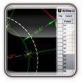
MicroSurvey Point Prep
€1,089.46
€885.74
A simple-to-use desktop-based product designed specifically for the construction layout professional. Point Prep is used to open and save DWG and DXF files and allows you to quickly review, calculate, and extract points from a drawing for layout in the field.
If you are familiar with a CAD-based system, you can be drafting and calculating with MicroSurvey Point Prep in as little as a few hours. If you have never used a CAD based system, you can be drafting and calculating in as little as a day.
MicroSurvey Point Prep is a standalone program, but syncs easily with MicroSurvey Layout so points and drawing data can be easily used at the job site for layout.
Availability:
In stock
SKU
msc-4
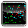
MicroSurvey embeddedCAD, powered with Autodesk technology, is 100.0% compatible with AutoCAD® DWG® files. It's a fully-featured standalone surveying powerhouse with an industry-leading CAD engine.
Old habits are hard to break. This program is built for surveyors that want to stick with a traditional CAD interface and engine, while having the ability to compute coordinates, balance traverses, annotate drawings, compute areas, and use every other tool relevent to the modern surveyor.
 100.0% AutoCAD and 100.0% DWG Compatibility
- Command familiarity shortens learning and widespread AutoCAD training helps get users more productive.
- Autodesk RealDWG engine is included.
- Object enablers for Autodesk Civil3D can be installed.
 Powerful Survey Calculations
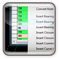
- Batch COGO – automatically record entries in our spreadsheet-style editor and reprocess!
- Compatible with data from all major total stations and data collectors.
- Easy coordinate transformations including UTM, State Plane, and MTM.
 Complete Traverse or Network Adjustments
- Angle and vertical balance, transit, compass, Crandall’s rule.
- Blunder detection, full 3D least squares adjustment.
- Graphical ellipse display, instrument storage, reprocessing and pre-analysis.
 Integrated Survey, Design, and CAD
- Download, calculate, design, draft, check, and print – all incorporated into a field-to-finish package.
- The most "surveyor friendly" AutoCAD add-on available.
 Smart Information
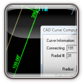
- Smart Objects: lines, points, curves and text.
- Pick and edit objects automatically without initiating a command.
- Browse the entire coordinate database by simply picking any point in your drawing.
 Active Drawing Technology
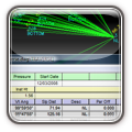
- MicroSurvey's Active Drawing Technology enables verification, editing, printing, and manipulation of data in the drawing, in the coordinate and traverse databases, and during batch COGO calculations.
 Complete Site Design
- Site design: Ponds, ditches, stockpiles, and slopes.
- Road design: Horizontal and vertical alignments, cross-sectional templates.
- Create cross sections of existing ground and design surfaces.
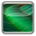
 Powerful DTM Contouring/Modeling Volumes
- 3D rendering.
- Virtually unlimited point capability.
- Simple to use: create a DTM and contour in four simple steps.
 Learning Resources
- 12 hours of built-in training movies equivalent to thousands of pages of documentation.
- Complete CAD documentation with movie links.
- Context-sensitive HTML Help Menu system is easy to use.
Quality Tools for Excellent Value
- Full-featured software for greater efficiency at a lower price.
- Portable USB keys for license flexibility – share with other users and switch devices easily.
- Connected device becomes MicroSurvey License Server.