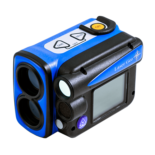
Haglof - Laser Geo 2, Built in GPS & Compass Rangefinder, Hypsometer, Bluetooth, Compass & GPS
Features & Benefits:
The LASER Geo 2’s unique capabilities allow you to measure, map, process and store forest and field data in ways you never thought were possible!
Long-range measurement with high-precision laser and integrated tilt and compass sensors for accurate 3D measurements. Results are displayed on an integrated heads-up display and an external graphical display.
Programmable:
The Laser Geo 2 instrument features an advanced platform that allows you to download and install new apps tailored to your requirements. Additionally, we can create a custom app based on your specific preferences. Upon delivery, the instrument includes a pre-installed Standard App, which offers the same functions as its predecessor Laser Geo, along with enhancements and new features like Remote Diameter.

Height & Canopy
Heights
3-point, 2-point or 1-point or direct measuring – choose preferred method to work with in the easy-to-follow menu system.
The 3D Vector function allows you to measure remote targets such as canopy width.

3D Map Area
Areal measuring
Use built in GPS to walk and log an area.
Or stand in the middle of the area and use the built in GPS, Compass, Laser and measure the points on the border of the area.
See results directly in Google Earth or other similar geographic applications.

Line Clear
Hazard trees
Line Clearance function.
- Measure on the wire
- Measure the tree height
- The unit calculates if the tree will fall on the wire or not.
- The unit calculates and present how much the tree will hit the the line or how much will go under the line.

Standard applications Laser Geo 2
Explore all measurement capabilities with the Laser Geo 2, equipped with the Standard application. Whether you’re measuring heights, distances, or mapping and processing forest and field data, Laser Geo 2 makes the impossible possible!
Key Features:
- Long-Range Precision: High-precision laser technology for accurate measurements over long distances.
- Advanced 3D Measurements: Integrated tilt and compass sensors ensure precise 3D data.
- User-Friendly Displays: View results effortlessly on the integrated head-up display and external graphic display.
Transform your data collection and processing with Laser Geo 2 – the ultimate tool for precision and efficiency!
- However, users can also download, install, and run additional apps to access specific functions not included in the standard app. It is possible to switch between installed apps in the field at any time.
Features
The VERTEX LASER GEO 2 with unique capabilities will allow you to measure, map, process and store forest and field data in a way you didn’t think was possible! Long range measurement with high precision laser and integrated tilt- and compass sensors for accurate 3D measurements. Results are presented in an integrated heads-up display and external, graphic display.

Tree heights
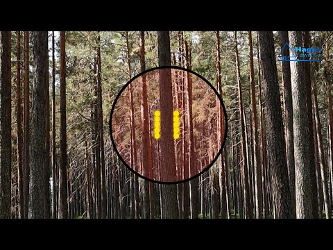
3-point, 2-point or 1-point or direct measuring – choose preferred method to work with in the easy-to-follow menu system. A nonmagnification dot sight helps you to identify individual targets such as tree tops and power lines.

Map Area
Use built in GPS to walk and log an area.
Or stand in the middle of the area and use the built in GPS, Compass, Laser and measure the points on the border of the area.
See results directly in Google Earth or other similar geographic applications.

MAP Wood chip or Gravel piles
MAP Wood chip piles

Line Clearance
Hazard trees
Line Clearance function.
- Measure on the wire
- Measure the tree height
- The unit calculates if the tree will fall on the wire or not.
- The unit calculates and present how much the tree will hit the the line or how much will go under the li
GPS and Mapping
The built-in GPS receiver allows you to tag data with coordinates with the push of a button. Data is stored on a built-in SSD memory and is available for further processing via a standard USB connection to any PC or Apple computer. Files can be opened directly in your favorite GIS or spreadsheet application. Complex operations such as area measurement, 3D target mapping, and trail mapping have builtin capabilities.
The 3D vector function allows you to measure remote targets such as canopy width. The instrument can also connect to an external Bluetooth GPS and use its coordinates for better accuracy.
- The receiver is a 33-channel high sensitivity receiver.
- Supports: GPS, Glonass, Galileo, QZSS.
- Built-in real tme correction w SBAS (EGNOS, WAAS, MSAS, GAGAN) Accuracy down to 2.5m/8.19ft in open terrain.
- Satellite position prediction for up to 3 days. Host Based multi-global navigation satellite system GPS(USA)/GLONASS(Russia)/Galileo(EU)/QZSS(JAPAN) SBAS Satellite-based augmentation systems: WAAS(US) EGNOS(EU)
GAGAN (India) MSAS(Japan). - Built-in self-generated orbit prediction (Faster TTFF up to 3 days), built-in jamming removing.
- Accuracy: Automatic position 2.5m CEP (circular error probable) (50% 24 hr static, -130dBm. Speed 0.1m/s (50%@30m/s.

3D Vector
The 3D Vector function allows you to measure remote targets such horizontal distances and angles between two points far ahead in the terrain such as canopy width or width of a river.

MAP Trail
Your content goes here. Edit or remove this text inline or in the module Content settings. You can also style every aspect of this content in the module Design settings and even apply custom CSS to this text in the module Advanced settings.

Azimuth
Your content goes here. Edit or remove this text inline or in the module Content settings. You can also style every aspect of this content in the module Design settings and even apply custom CSS to this text in the module Advanced settings.
3D Pile
Expand the possibilities of your Laser Geo or Vertex Laser Geo with the 3D Pile application.
Specially adapted for Log and Stockpile inventoryanced settings.
Use the 3D pile application in your Laser Geo or Vertex Laser Geo to measure the volume of any irregular stockpile or log piles.
This complete system allows one person to perform the entire job without other instruments
Features
- Inventory and volume estimation of log piles
- Inventory and volume estimation of irregular piles of different materials.
- One person can perform the entire process
- Obtain field data with high accuracy and precision
- Store data directly in the instrument
- Avoid walking and climbing in hazardous areas

Log Pile Volume
The Log pile can be divided into several sections during measurement. The sum of the sections is then the total length of the pile. Measure and record pile width, range and wood volume factor for each section. The volume is calculated by section number, number of heights, calculated average height, and volume for each section. The result includes the calculated average width of each section, the calculated average height of all measuring points, and the default wood volume factor for each section.

Woodchip or gravel piles
The 3D PILE software is useful for measuring different types of piles and rollers. Measure the pile from different sides to create a three-dimensional image of the object. The instrument saves heights and coordinates for all measurement points. Data is stored in (csv) and (kml) formats and can be opened directly in Google Earth! The instrument can also be used to calculate 2D areas (area), such as clearcuts, industrial sites or the inside of a building.
Do you already own a instrument?
If you already have a Laser Geo or Vertex Laser Geo, you can purchase this firmware application 3D Pile and update your device and start your work!


