
3D Scanning
3D Laser Scanner
A 3D laser scanner is a surveying instrument used to capture accurate digital representations of physical environments. By emitting laser beams and measuring their return distance, the system records millions of measurement points across surfaces and structures. These measurements form a detailed point cloud, allowing professionals to create precise digital models of buildings, infrastructure, and construction sites.
3D laser scanner technology has become widely used in construction, surveying, and engineering projects where accurate documentation of existing conditions is required. The ability to rapidly capture large volumes of data allows teams to measure complex environments with a high level of consistency while reducing time spent on site.
What Is a 3D Laser Scanner?
A 3D laser scanner measures distances using laser pulses to calculate the position of surfaces within a defined space. As the scanner rotates or moves through an area, it records thousands or millions of measurement points. These points collectively form a point cloud that represents the geometry of the scanned environment.
The resulting data can be used to generate accurate digital models, perform structural analysis, or verify construction alignment against design plans. A 3D laser scanner is particularly useful for capturing environments that would be difficult or time-consuming to measure using traditional surveying methods.
Because the scanning process captures large areas quickly, the equipment allows engineers and surveyors to document existing conditions efficiently without interrupting ongoing site activity.
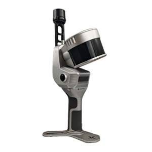
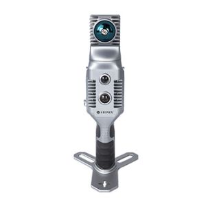
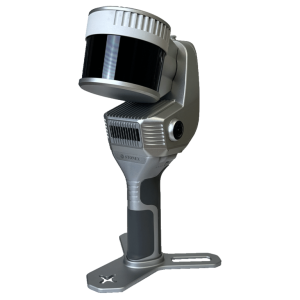
Types of Laser Scanning Equipment
Laser scanning equipment is available in several configurations, depending on the scale and requirements of a project. Static terrestrial scanners are commonly used for high-accuracy documentation of buildings, structures, and industrial facilities. These systems are typically mounted on tripods and capture detailed data from fixed positions around the site.
Mobile scanning systems allow operators to move through an environment while collecting data continuously. These systems reduce setup time and improve productivity when scanning large or complex spaces.
Modern laser scanning equipment is designed to balance measurement accuracy, scanning speed, and portability. The choice of system usually depends on the size of the project area, required data resolution, and how quickly the environment must be captured.
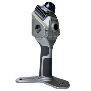
SLAM Laser Scanner Technology
A SLAM laser scanner uses Simultaneous Localisation and Mapping technology to determine its position while capturing data. Unlike traditional scanners that rely on fixed setups, SLAM systems track movement through sensors and algorithms, allowing the operator to walk through the environment while recording measurements.
This approach significantly reduces setup time and enables efficient scanning of long corridors, industrial facilities, and complex interiors. A SLAM laser scanner is particularly useful where traditional tripod setups would slow down the data collection process.
SLAM technology allows surveyors to capture large spaces quickly while still maintaining a reliable geometric representation of the environment.
Applications of 3D Laser Scanning
A 3D laser scanner is used across many sectors where accurate measurement and documentation are essential. In construction projects, scanning helps verify site conditions, monitor structural alignment, and compare completed work against design models.
Surveyors use a 3D laser scanner to document terrain, buildings, and infrastructure before development begins. The captured data supports planning, modelling, and coordination between project teams.
Industrial facilities often use scanning to record existing layouts for maintenance planning or equipment installation. Heritage conservation projects also rely on scanning technology to document historic structures while avoiding invasive measurement methods.
By capturing large areas quickly and accurately, scanning technology improves project coordination and reduces the risk of measurement errors.
Choosing the Right 3D Laser Scanner
Selecting the appropriate system depends on several factors, including the scale of the project, required measurement accuracy, and the environment being scanned. Large infrastructure projects may require equipment capable of covering significant distances, while interior surveys may prioritise portability and ease of movement.
The choice of laser scanning equipment should also consider how the data will be processed and used in downstream workflows. Some projects require highly detailed point clouds for modelling, while others may prioritise rapid site documentation.
At Celtic Surveys, we work with surveying and engineering professionals across Ireland to provide laser scanning equipment suited to construction, infrastructure, and industrial applications. Selecting the right 3D laser scanner ensures accurate data capture and reliable results throughout the project lifecycle.
If you require further information on laser scanning equipment or guidance on selecting the appropriate system, our team can assist based on your project requirements.